This image was part of a panorama project I undertook for a client in Oldham in the UK. I photographed the panorama from high in the Pennine Hills above his house. You can clearly see, from 40 miles away, the tower at Daresbury, the arch of the Runcorn Bridge and the Fiddler’s Ferry power station on the Manchester Ship Canal.
In the background are the Clwyd Hills on the left. In the distance on the right you can make out the mountains of Snowdonia, about 90 miles distant. When the image is enlarged, you can clearly see the ridge of Tryfan soaring into the clouds. This triggered a discussion on the UKClimbing website about distances you could see from hilltops in the UK.

Outcome
After long discussion, I printed the image about 1 metre across for displaying in my client’s dining room. We wanted to maximise the close-up detail in the panorama while retaining the impact of a large picture. Any larger and the print becomes too blurred when examined closely, and my client was keen to able to enjoy the details.
In the full size picture we printed, you can make out jet planes circling Liverpool airport. You can see one in the image above, to the right above the power station in a brighter cloud.
With over 90 miles of sky to go at, there’s bound to be a lot of interest in the clouds. The dark clouds were a storm just passing through leaving clear blue sky behind, followed an area of higher pressure, and with the next sunlit front coming in just behind again.
The weather conditions were quite unusual for that part of the country. Not for nothing did the cotton mill owners build their mills in the damp foothills of the Pennines. Wet grey days are the norm and suit the spinning of cotton. Catching weather fronts like these was quite special.
Other projects
-
Leader Water – a finished project
The Leader Water is the third in a series of three books featuring woodland in the Scottish Borders. A finished project? Well, maybe for the time being.
-
Woodland
Woodland, the second of three books about the woods and trees in the Scottish Borders. It follows on from The Heron Wood. Here are some of the images you’ll find in it. Watch this space soon for an update on Volume 3 – Leader Water.
-
The Heron Wood Project
COVID lockdowns brought frustrations but they also provided us an opportunity. The resulting pictures of the local Heron Wood reflected the complexity of the situation. They are now available in a new book from Blurb Books
-
The Light in the Shadows
Creating a book from a website feels like it should be easy. But it turned out not to be like that at all.
-
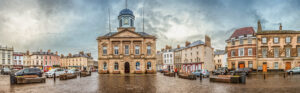
Kelso Town Hall and Square 2016
In 2016 I developed a series of images to create a panoramic view of the Square in Kelso. I felt it would be both interesting and useful to record the current state of the Square.
-
The Tweed Crossings Project 2016 –
Maps identify over 30 river crossings on the Tweed between Kelso and Berwick in the borderland joining England and Scotland. Many, especially the fords and ferries, have now vanished. But each of them has a story to tell in the turbulent history of the region.


No post found!